Multiresolution Mapping of Land Cover From Remote Sensing Images by Geometric Generalization

Abstarct
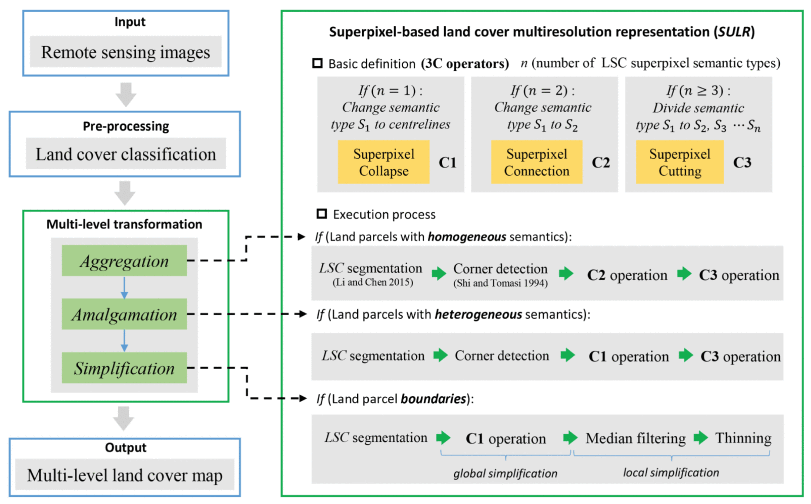
Land cover multiresolution mapping of remote sensing images contributes greatly to land-use management, environmental protection, and city planning. In traditional mapping of this type, the representation of different land-use types depends on the image resolution, and the geometric, topologic, and semantic characteristics are not considered. This approach can cause a loss of useful information and the redundancy of useless information. In this study, we propose a superpixel-based land cover (multiresolution representation SULR) method for remote sensing images that employs multifeature fusion. In this process, we first define three basic superpixel operations, collapse, connection, and cutting, as the basic operators of multiresolution land cover mapping. Then, the topological adjacent land parcels are combined through the amalgamation of polygons with heterogeneous properties and aggregation of polygons with homogeneous properties based on the three proposed superpixel operators. Finally, the geometric boundaries of parcels are simplified by combining the superpixel collapse operator and image thinning technologies. Compared with traditional image scale transformation methods, the proposed method can more effectively achieve multiresolution mapping of land cover from remote sensing images by considering the geometric, topologic, and semantic characteristics of land parcels.