SGCN: A multi-order neighborhood feature fusion landform classification method based on superpixel and graph convolutional network

Abstarct
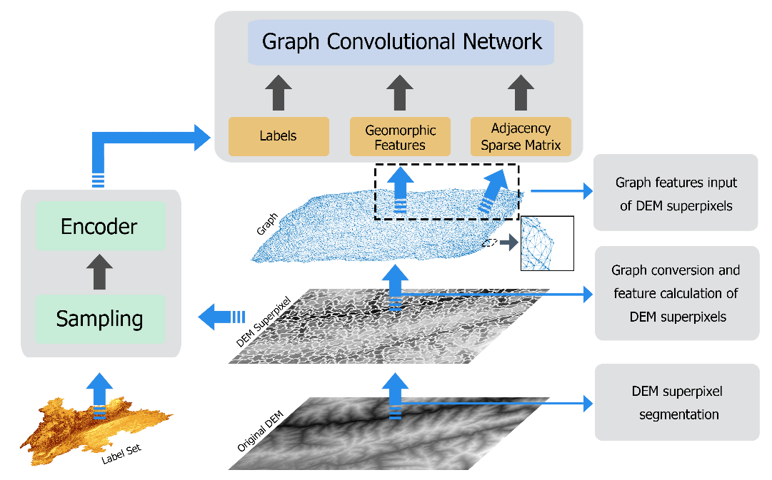
To address key issues with traditional landform classification methods that impact the integrity and continuity of the analysis area, as well as neglecting neighboring features, We presents a novel approach called superpixel-based graph convolutional network (SGCN) for automatic classification of digital elevation model (DEM) landform. The SGCN uses superpixel segmentation and graph convolutional networks (GCNs). Specifically, we employ the Simple Linear Iterative Clustering (SLIC) algorithm to perform superpixel segmentation on the DEM image and convert the resulting distribution of superpixels in the 2D image into a graph structure, where nodes are labeled. We then analyze the geographic features and external neighborhood relationships within each DEM superpixel to obtain corresponding node information for the graph structure. Finally, the GCN model is trained according to the graph structure, node feature information, and node label, enabling automatic recognition of node landform types. Importantly, SGCN accounts for the multi-order neighborhood features of the basic analysis unit and expresses the DEM micro-features relatively macroscopically. Experimental results demonstrate that compared with pixel-level semantic segmentation methods like U-Net, FCN, and SegNet, the SGCN significantly improves DEM landform classification accuracy by 17.84%, 33.22%, and 30.60%, respectively. Moreover, SGCN better preserves the integrity and continuity of features inside and outside the analysis area, overcoming the limitation of traditional methods that use regular grids as the basic analysis unit, which can compromise landform edge continuity.